| HOME | RESEARCH | NEWS/EVENTS | LIBRARY | LINKS | DOWNLOADS |
| Overview | Expert Groups | Special Interests | Conferences |
RESEARCH
Report Meeting Zagreb
Report on the 9th meeting of the ICPDR RBM/EG on 9th to 10th October 2002 in Zagreb
The 9th meeting of the RBM/EG of the ICPDR took place in Croatian capital on the river Sava Zagreb.
After the usual opening of the meeting by Ursula Schmedtje, the chairman of the RBM/EG Fritz Barth reported on the Chairpersons Meeting concerning WFD implementation, that had taken place at the same place in Zagreb just on the previous day.
The leader of the UNDP/GEF Danube Regional Project Mr. Ivan Zavadsky informed the group on the activities related to the implementation of the WFD considering surface water bodies, groundwater bodies, development of Danube GIS, economic analysis and Sava pilot project.
Ms. Rayka Hauser from WWF office in Bulgaria made a presentation on their engagement on public participation component in frames of the GEF project. The country representatives have reported extensively on the work done on the public participation in the meantime in their countries.
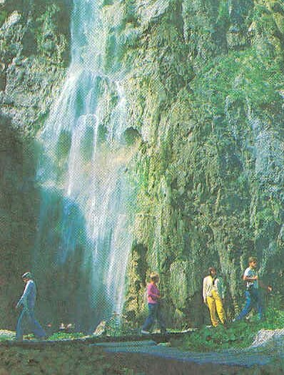
 The field trip to the National park Plitvice Lakes showed that the wellknown hydrographyc phenomena consisting of karst lakes and waterfalls may show their full beauty in autumn even under intensive raining. Situated in the eastern part of Lika, between the mountains of Mala Kapela and Licka Pljesivica, just 3 hours ride from Zagreb. As a national park since 1949, it has been inscribed in 1979 on the UNESCO's world heritage list. Water flowing over the limestone and chalk has, over thousands of years, deposited travertine barriers, creating thus natural dams which in turn have created a series of beautiful lakes, caves and waterfalls. The largest of sixteen lakes Kozjak (0. 8 km²) is also the deepest one (46 m). The park covers an area of 200 km². The forests in the park are home to bears, wolves and many rare bird species.
One the second day Ursula Schmedtje reported on the Cartography and GIS Expert Subgroup. The issue paper on development of Danube GIS and EuroGlobalMap have been presented. Definition of the Danube river Basin district borders (including coastal waters) has been discussed through the national representatives. Proj. Ijjas (HU) presented his paper on traunsboundary issues.
Ms. Schmedtje has presented the draft TOR for the economic analysis.
A draft proposal for a technical outline for the DRB Management plan prepared by Austra and Germany has been discussed.
Status of task implementation of the Work Plan has been reviewed especially phase II and III.
National representatives have reported on proposals for ISPA pilot river basin projects. Some countries have already submitted their proposals to the EU.