| HOME | RESEARCH | NEWS/EVENTS | LIBRARY | LINKS | DOWNLOADS |
| Publications | IAD-Library | Map Collection/Geodata | Picture Gallery |
|
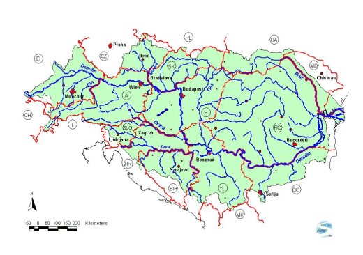
LIBRARY IAD Basemaps Danube Basin This map compilation contains downloadable basic GIS data. Most of the data is based on the freely available DCW (Digital Chart of the World, now Vmap Level0) and was compiled for the Danube River Basin by Ulrich Schwarz. The data is available in "Shape format" and editable in standard GIS applications e.g. ArcView, Arcexplorer (free GIS-Viewer), MapInfo or Geomedia. It is every time possible to re-project the data for your usage (Geographic or UTM/Gauss Krüger for each country). The data is provided for internal IAD usage and educational projects. For questions please contact . The used SVG technology for the large interactive online-maps in this section is actually slow, so please take a while to load and interact the SVG-projects in your browser! I used a large map-extend for a maximum map-window on screen (optimised for 19'', 1024x768). Please scroll right and down for the legend and map explanations. |
||
